
3D Data Visualisation Tools
Combine the power of 3D city models with planning data from public and private sources to gain deeper insight into your site and its context.
Whether you're importing your own datasets, creating layered visualisations, or tracking development over time, VU.CITY helps you make evidence-based decisions with clarity and speed.


Explore VU.CITY's 3D development tools
Visualise ideas instantly with the Create Tool.
Sketch massing, test height and footprint, and create new development forms directly within VU.CITY. Whether you're assessing feasibility or exploring early concepts, the Create Tool lets you quickly model new schemes in their real-world context.
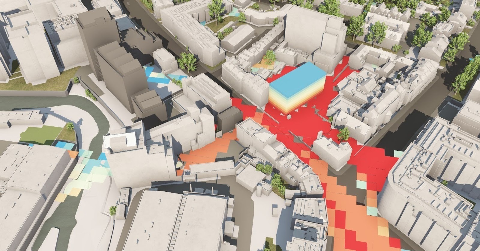
Drag and drop your 3D model into VU.CITY to instantly view your scheme in full city context.
No complicated setup—just quick, clear visualisation for faster design reviews, stakeholder engagement, and planning submissions.
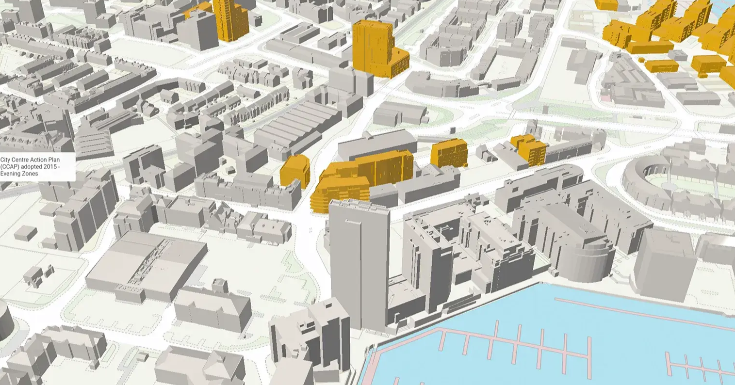
Track what's built, approved or coming soon. Visualise the full development lifecycle—view consented, under-construction and completed schemes directly within the model.
The Timeline Tool helps you assess future pipeline, avoid conflicts, and shape proposals with a clear understanding of what’s happening around your site.
VU.CITY Case Studies
See how leading built environment experts are using VU.CITY
-1-1-1.png)
VU.CITY seamlessly integrates with leading 3D digital software for an easy fit into existing workflows.
We are compatible with the biggest 3D software providers so that you can focus on your designs and plans with minimal disruption.
SiteSolve is our early-stage site exploration and generative design tool. Find out more.

Optimise FBX exports from Revit with our VU.CITY Revit Plugin and Update Agent. Embed materials, maintain positioning, and more.
Export SKP models to FBX using our VU.CITY SketchUp Plugin (beta). Produce FBX files optimised for use in VU.CITY.
Optimise and fix common issues with FBX models using our VU.CITY Blender Add-in. It's the best model editor we've come across.
Trusted by 6,000+ users across 26 cities
Architects, developers, local authorities, urban planners, and more trust VU.CITY to help achieve their goals.
Organise and visualise your geospatial data in accurate context with our comprehensive suite of digital design and development tools.
Developments FAQ
Frequently Asked Questions about VU.CITY's Developments.
What does it mean to import 3D models into urban planning software?
Importing 3D models into VU.CITY enables you to integrate your existing designs directly into a dynamic digital twin of your urban environment. This process lets you visualise, modify, and analyse your models within a comprehensive planning context, streamlining the transition from design to actionable insights.
How do VU.CITY’s urban development tools facilitate the import and export of 3D models?
Our platform is designed with flexibility in mind, allowing you to easily import 3D models from various file formats and export them once your project is complete. This seamless integration ensures that you can work with your familiar design tools while benefiting from VU.CITY’s advanced urban planning capabilities.
What are the benefits of the save/load functionality in VU.CITY’s developments feature?
The save/load feature lets you store your project’s progress at any stage and return to it later without losing modifications. This ensures that developers, architects, planners, and local authorities can collaborate efficiently, update their work in real time, and maintain a clear record of project evolution.
How do the timelines enhance the urban planning process?
The timelines feature provides a unique view into both historical data and future projections, enabling you to track urban changes over time. This dynamic tool supports strategic planning by illustrating how developments have evolved and where future opportunities may lie, making it a key asset in your urban development toolkit.
Who benefits from these 3D urban planning tools?
Our tools are designed for a wide range of built environment professionals—including developers, architects, planners, and local authorities. By integrating your own 3D models and leveraging features like timelines, you gain a powerful platform for visualising complex projects, conducting feasibility studies, and making data-driven decisions.
How can I get started with importing 3D models into VU.CITY?
Getting started is easy. Sign up for VU.CITY with the form below and start your free trial today. You can also contact us if you prefer. Once integrated, you can immediately begin using our urban development tools to analyse timelines, refine designs, and enhance your overall planning process.
26 UK & International Cities
Over 3,000+ sq km accurate to 15cm | Tools to scope, create & collaborate on designs
Explore digital 3D geospatial solutions for the built environment
VU.CITY provides clear, powerful tools for key decision-makers across the built environment, helping them visualise and shape the future of cities with confidence and precision.
Make smarter decisions with data-driven insights, from infrastructure to sustainability.
Unlock the power of Generative AI for optimal design and streamlined decision-making.
Bring your designs to 3D life with state-of-the-art modelling tools.
Collaborate seamlessly across studies, planning, and design.
Utilise advanced 3D models and a data-driven approach with our flexible ZTV service.
Bring Your Vision to Life with a 3D Flythrough Video.
Shape Tomorrow’s Cities, Today.
Begin Your Free Trial Now.
