

| Project: | Visual impact assessments |
| Partners: | Lichfields Planning and Development Consultancy |
| Focus: | VIA, protected views, conservation areas, listed buildings. |
Challenge: Lichfields' Townscape and Visual team needed a more efficient way to assess the visual impacts of development proposals at the early stages of a project, particularly for sensitive sites involving protected views, conservation areas, and listed buildings. Traditional methods were time-consuming and often required extensive back-and-forth with clients, architects, and planning authorities before key constraints could be identified and addressed.
Solution: VU.CITY's 3D digital twin platform, enabling real-time viewshed analysis, massing studies, and accurate visual impact assessments across multiple UK cities.
Results: Significant efficiency gains in scoping assessments, early identification of critical design constraints (such as protected view corridors), faster stakeholder collaboration, and more focused assessments that respond to key issues from the outset of projects.
We sat down with Colin Smith, Senior Townscape Consultant at Lichfields, whose background in architecture and four years of experience with VU.CITY has made him a key user of the platform for townscape and visual impact assessments throughout the design and planning process.
The challenge
For townscape consultants, understanding how a proposed development will appear from multiple viewpoints—especially protected views and sensitive heritage locations—is fundamental to the planning process. However, during the early stages of a project traditional assessment methods can be labor-intensive and slow, making it difficult to:
- Quickly identify all sensitive viewpoints from which a development might be visible
- Test multiple design iterations efficiently
- Provide clear, understandable visual evidence to clients, design teams, and local authorities
Without the right tools, teams risk spending significant time on abortive work or missing critical constraints until late in the design process, when changes become costly and time-consuming.
Additionally, at the post-submission stage further requests for information (i.e. additional views) may be sought from stakeholders, which need to be provided in a timely manner in order to ensure minimal delay to a planning decision being made.
The solution: VU.CITY as a core assessment tool
Lichfields integrated VU.CITY into their workflow as an essential platform to assist with townscape and visual impact assessments. The team primarily uses VU.CITY at the early stages of the design and planning process, working collaboratively with architects and local authorities before applications are submitted.
Key Workflow Applications
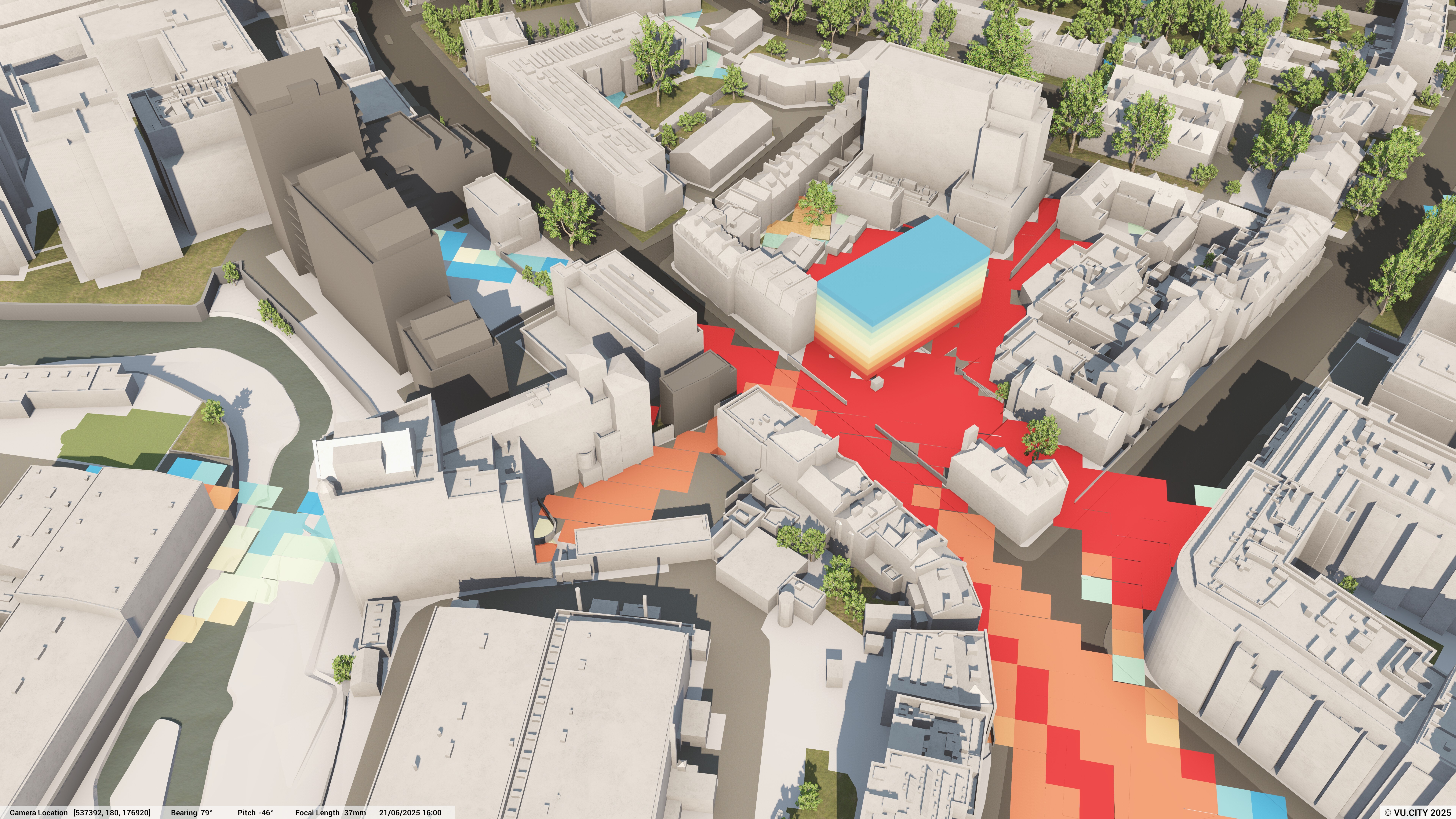
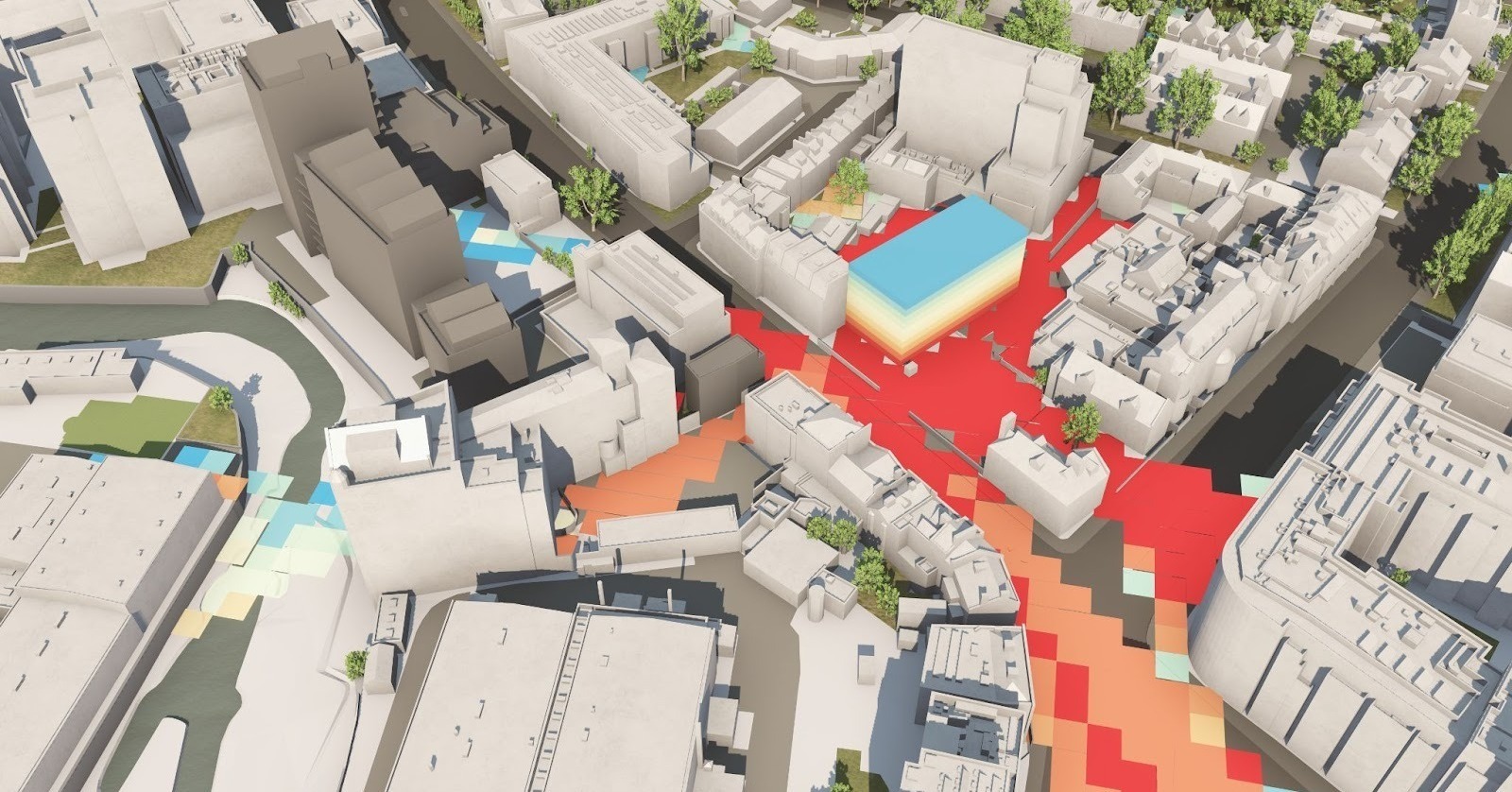
Initial Viewshed and Zone of Theoretical Visibility (ZTV) Studies
The team begins most projects with an initial Viewshed/ZTV study in VU.CITY, combining this with relevant data layers such as Conservation Areas and Listed Building Points. This allows them to establish the most sensitive views from where a proposal may be visible, creating a robust foundation for their assessments.

Viewshed analysis with data overlays helps identify the most sensitive locations for detailed assessment
Testing Design Iterations
As schemes develop, the team tests various massing iterations against the established sensitive viewpoints. Colin recalls a particularly crucial moment: "On a particular scheme incorporating a tall building, testing in VU.CITY established that the proposal would encroach on the protected silhouette of the Tower of London - this helped aid discussions with relevant stakeholders and ultimately informed a maximum height datum at the outset of the project."
This early identification of constraints saves significant time and resources by preventing abortive design work.
Camera Tool and Verified View Preparation
The Camera tool allows the team to fine-tune key visibility areas established by the viewshed/ZTV. "VU.CITY allows us to create views that are representative of the final verified visualisations typically included in our assessments through the various sliders allowing for adjustments to focal lens and pitch," Colin explains.

Street-level view with summer foliage - Camera controls enable precise view testing that matches the parameters of final verified visualisations
Seasonal Visibility Analysis
Visibility states are particularly valuable for assessing year-round impacts. The team can remove leaves from trees to provide an accurate indication of visibility during winter months, ensuring their assessments account for seasonal variation.

Same street view with winter/leafless trees - Visibility states allow assessment of seasonal variations, demonstrating how winter visibility changes through deciduous tree cover

Zoomed perspective through bare trees - Detailed visibility testing helps determine actual impact on sightlines to heritage assets throughout the year
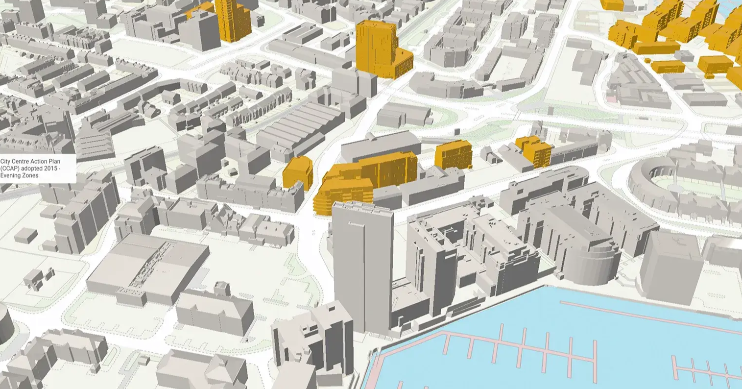
Timeline Tool for Future Context
The Timeline tool proves highly informative when considering how a development might fit within an emerging or future context, allowing the team to account for cumulative impacts of planned developments in the area.

Riverside view with proposed development

Riverside view with contextual buildings in view
The Results
Time Savings and Efficiency Gains
"The platform has provided huge efficiency gains in terms of how we establish the scope of our assessments, allowing us to consider a large number of view locations with ease," Colin notes. The ability to rapidly test viewpoints means the team can be comprehensive in their initial analysis whilst ensuring robust feedback is provided to clients, design teams and stakeholders in an efficient manner.
Post-submission, VU.CITY enables rapid responses to additional stakeholder requests. "Occasionally, we'll need to provide further information post-submission - for example, additional views of a proposal that may be requested by a particular stakeholder. Using VU.CITY means we can do this in a timely fashion and ensure minimal delay to a planning decision being made."
Improved Accuracy and Focus
Three-dimensional visualisation gives the team a more accurate understanding of a proposal's visual impact at a much earlier stage. "Being able to visualise a development in context in three dimensions has given us a more accurate understanding of its impact on the townscape setting at a much earlier stage, allowing for more focused assessments that respond to the key issues."
Enhanced Client Communication and Collaboration
VU.CITY has also helped Lichfields communicate with clients, planners, and design teams.
The platform's collaborative features are particularly valuable: "We can use the platform as part of interactive workshops or invite team members to join a VU.CITY project directly - this allows for greater collaboration and helps to speed up our workflow considerably, as we don't need to spend time exporting outputs from the platform."
The team has received overwhelmingly positive feedback from clients and architects. Colin's advice to other consultancies considering VU.CITY? "I'd really recommend VU.CITY as a collaborative tool - we've had a lot of positive feedback from architects and clients who have found it a hugely useful resource in giving them a greater understanding of their emerging proposals."
Looking Ahead
For Lichfields, VU.CITY has become an indispensable tool in their townscape and visual assessment workflow. It provides a comprehensive solution that touches every stage of their process—from initial scoping and design testing to stakeholder engagement and post-submission queries.
By enabling faster, more efficient assessments and fostering better collaboration across project teams, VU.CITY helps Lichfields deliver high-quality townscape and visual analysis that serves the best interests of their clients, local communities, and the built environment.
About Lichfields
Lichfields is a leading planning and development consultancy with over 25 years of experience analysing the townscape and visual effects of high-profile, tall, and sensitive projects across the UK. Their dedicated Townscape and Visual team works on everything from masterplans to singular tall buildings, drawing on deep planning expertise and collaborating closely with internal Urban Design and Natural Light Consultancy teams.
See how VU.CITY can help your team today
VU.CITY Case Studies
See how more leading built environment experts are using VU.CITY
-1-1-1.png)
Shape Tomorrow’s Cities, Today.
Begin Your Free Trial Now.
