




.svg)

.svg)
.svg)
.svg)

.svg)
.svg)


.svg)


.svg)
.svg)
.svg)

.svg)


.svg)
.svg)
Bolster bids with 4D site planning.
From tender submissions and pre-construction planning through to site logistics and stakeholder engagement, we have the tools for your bid and project teams.
Combine your own site data with a survey-accurate 4D city model to demonstrate deep site understanding, strengthen your technical submissions and present schemes in a way that wins work.
For construction tenders and project planning
Our platform can be used by anyone - from total beginners to the absolute pro.
Sound familiar?
With VU.CITY
Our top tools for property construction professionals
Visualise, understand and communicate using our 4D maps.
Model import
Import building shells and structural models directly into the city context.
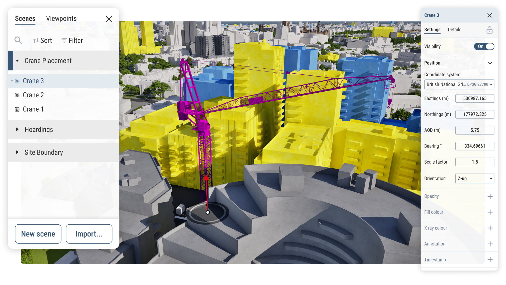
Custom object import
Add cranes, hoardings and other temporary site elements to cover every aspect of the site.
Site plan drawing
Draw and edit site plans, phasing boundaries and logistics directly within the 3D model.
Public and custom data layers
Import your data or third party data from any source and combine with our public library.
Phasing timeline
Track and present construction phasing over time using 4D time series data and models.
Quick Capture and image overlays
Generate high-quality, annotated images and 3D tours straight from the platform.
How VU.CITY works for construction teams
From early bid decisions to final site handover
Site logistics
Plan crane positions, swing paths, hoarding lines and laydown areas in real city context. Build trust in your bids and show your working.
Site appraisal
Scope a site and its constraints remotely. See risks, blockers and solutions all in one flow before committing bid resource.
Phasing and sequencing
Present your programme as a 4D timeline on the real site. Clients and evaluators see exactly how a scheme progresses phase by phase.
Neighbour impact
Demonstrate overshadowing, visual impact and street-level effect at every phase. Address concerns before they come up.
Data combination
Bring consultant data, ground surveys and traffic studies alongside public city data into one view for the whole team.
Hover over each card to see more
Join a community of 6000+ users across 200+ organisations




















Construction FAQ
Frequently asked questions from construction professionals using VU.CITY
How can I show site constraints and neighbouring buildings as part of a tender submission?
You can view a site and its surrounding area on an accurate 3D city model, including roads, traffic, environment and consented developments nearby, so you can demonstrate genuine site understanding rather than relying on a 2D drawing.
Can I show how a development will affect surrounding views and townscape?
Yes. You can model the proposed scheme within its real surrounding context and assess its visual impact on neighbouring buildings and the wider area, supporting the kind of evidence used in townscape and visual impact assessments.
Can I import building shells or structural models for a bid?
Yes. You can import shell and structural models directly into the 3D city environment, so your proposal sits accurately within the real site context rather than as an isolated render.
How do I show site phasing or sequencing to evaluators?
You can present construction phasing over time using 4D time series data, so stakeholders and evaluators can see how a scheme will progress through each stage, not just the finished result.
Can I combine my own consultant or ground survey data with public planning data?
Yes. You can bring in your own data, such as consultant studies, ground conditions or private intelligence, and combine it with public planning and city data in one contextual view.
Can data and visuals be shared across the rest of our project tech stack?
Yes. You can share documentation, data and insights generated in VU.CITY across your existing tools and project teams, so everyone works from the same source of truth.
Can I view a site and its surroundings remotely before doing a site visit?
Yes. You can explore any site within 26 UK&I cities on a survey-accurate 3D model, including neighbouring buildings, road widths, access points and public realm, which is particularly useful for early go or no-go decisions before committing resource to a bid.
How can I show build phasing and sequencing to a client or planning authority?
You can present your construction programme as a 4D timeline tied to the real site, so clients and evaluators see how each phase looks on the ground, not just a Gantt chart or a static diagram.
Can I model hoarding, laydown areas and site access in a real city environment?
Yes. You can add temporary site elements, including hoarding lines, access routes and plant positions, directly within the accurate surrounding city model, so your construction management plan is grounded in real geometry.
Can I combine my own consultant or survey data with city planning data in one view?
Yes. You can bring in ground surveys, traffic studies, geotechnical reports or any other consultant data alongside VU.CITY's public planning and city data, so the bid team has the full picture in one place rather than across separate reports and tools.