



.svg)

.svg)
.svg)
.svg)

.svg)
.svg)


.svg)


.svg)
.svg)
.svg)

.svg)


.svg)
.svg)
The most trusted, accurate 3D city models for every property decision
Sourcing tenants, marketing space, advising investors or defending a valuation? VU.CITY gives you the tools to go well beyond comparables and brochures.
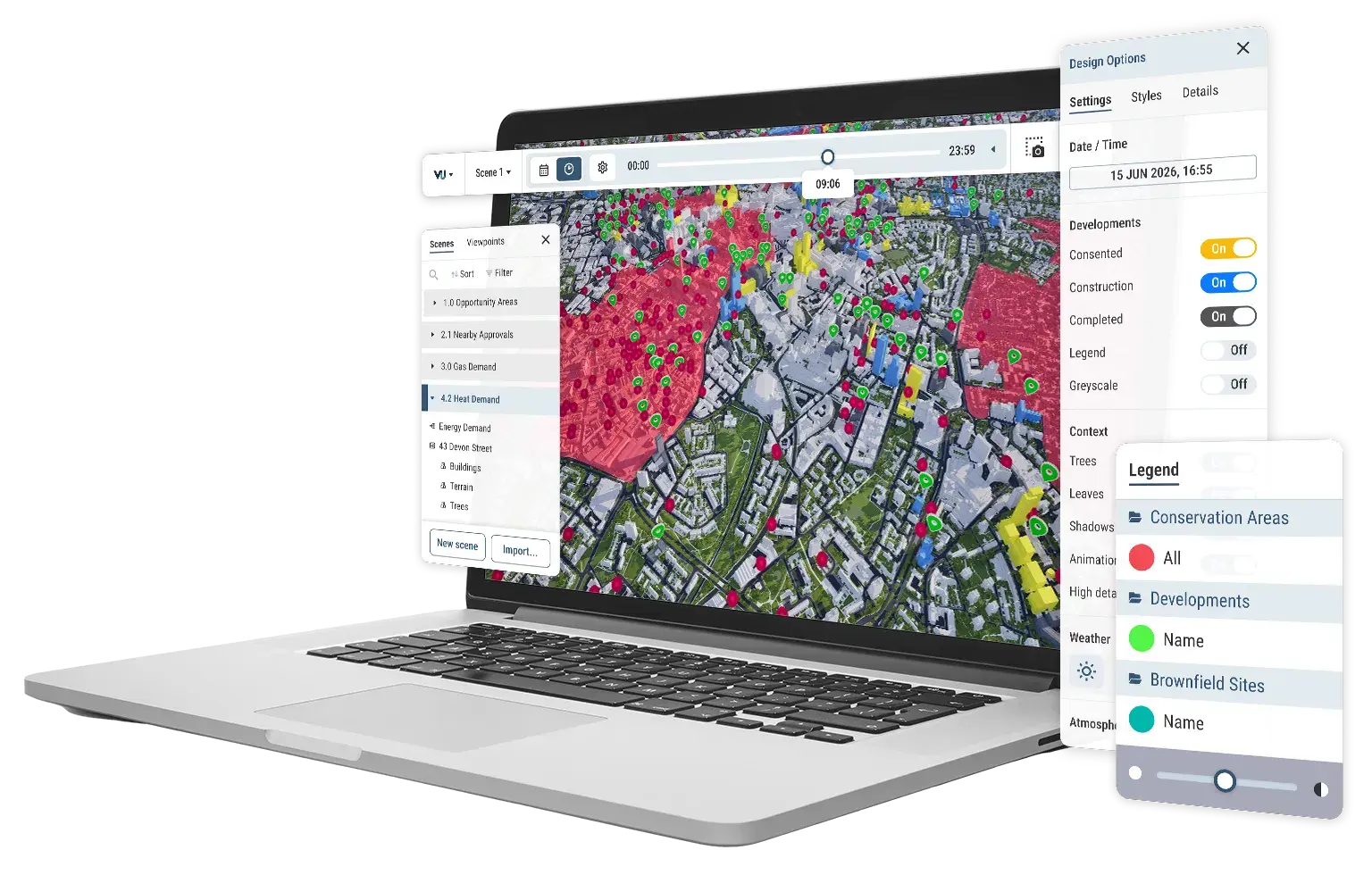
Combine property intelligence and immersive 4D city maps on one platform. Work across 26 UK&I cities, and present with the credibility that wins clients.
Win more mandates
Build trust and credibility
Work together, faster
Bring tenant rep, landlord leasing, ratings and investment teams onto one shared platform, reducing reliance on stretched GIS teams.
Work across 26 UK&I 3D city models with integrated GIS, data, planning and presentation tools.
Combine property intelligence, portfolio data and consented development context with your own valuation and market insight to build a fuller, evidence-backed picture of any asset or area.
Present pitches, valuations and appeals to clients, investors and stakeholders in a way anyone can understand.
Why VU.CITY?
Trusted
10 of our 26 UK&I city models are government-trusted, the only officially trusted spatial context available. Present on the same view local councils use to decide your client's scheme.
Accurate
All 26 of our city models are the most accurate, consistent managed models on the market. Survey-grade 15cm accuracy and detail everywhere, out of the box.
Cost-effective
Instantly access over 3,500km² of survey-accurate geometry, with integrated tools. Replace bespoke CGI, internal 2D tools and GIS specialist overhead with one subscription.
Our top tools for real estate professionals
Floor-by-floor mesh data and views
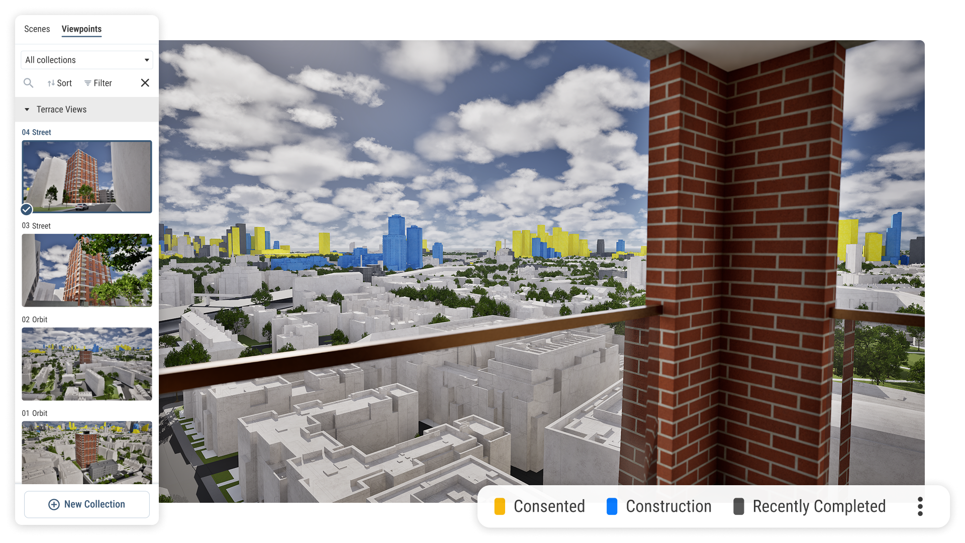
Apply data to individual floors and units of any building, including EPC ratings, existing tenants, fit-out category and lease terms. View from any floor in any direction.
Consented development timeline
See every approved and under-construction building automatically surfaced around any asset on a live timeline, evidence for pitches, valuations and appeals.
Portfolio and transaction visualisation
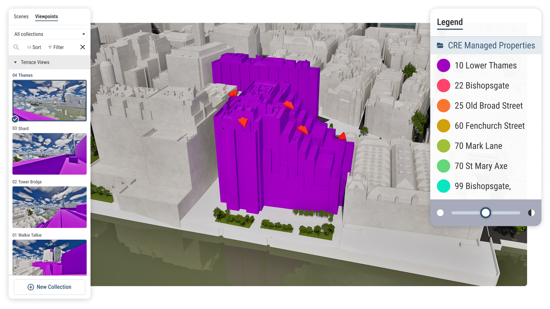
Plot a managed portfolio or client asset base on a survey-accurate 4D city map, with transactions, managed buildings and market data overlaid.
Off-plan and interior visualisation
Import architectural models and place them in the real surrounding city, with views from every floor and nearby consented schemes overlaid.
Live pitch presentations and shareable tours
Navigate around any building and its surrounding area live on screen, moving between viewpoints and highlighting data as you go.
High-quality imagery and export
Capture and export imagery from any view, exterior, interior, aerial or street level, for proposals, pitch decks and investor reports.
How different teams use VU.CITY
Pitch teams
Showcase your portfolio, transactions and market knowledge on a survey-accurate 4D city map. Demonstrate consented development intelligence live in front of clients, so innovation becomes a reason to choose you in every RFP.
Tenant representation
Go beyond a shortlist of available properties. Show clients exactly where each option sits in the city, views from every floor, floor-by-floor data including EPC ratings and existing tenants, and how the surrounding area is changing.
Landlord leasing and owner services
Present your managed properties and the areas around them with accuracy and impact. Show prospective tenants what is nearby, what is changing and why the location works for them, without relying on a design team.
Investment advisory
Present investment opportunities in full spatial context, with consented schemes, surrounding development and live data overlaid. Walk investment committees through an immersive view of any asset and the story behind it.
Join a community of 6000+ users across 200+ organisations




















Real estate FAQ
Why should I use VU.CITY over other 2D and 3D mapping tools?
What is the best tool for showing off-plan properties to buyers and tenants in the UK?
VU.CITY lets you import architectural models and place them accurately in the real surrounding city, so clients can explore the building before it is built, see the views from each floor and understand how nearby consented developments will affect the property over time. This works for both individual agents presenting a single off-plan unit and advisory teams handling large pre-let mandates.
How do I show international property clients the context of a UK building remotely?
You can navigate around any property and its surrounding area live on screen, from anywhere in the world. Clients see the building, its views, nearby amenities, transport links and consented development in full city context without travelling. This is particularly valuable for international investors and occupiers making decisions about UK city buildings without the ability to visit in person.
How does VU.CITY support tenant representation teams?
Tenant rep teams use VU.CITY to go beyond a shortlist of available properties. You can show clients exactly where each option sits in the city, apply floor-by-floor data including EPC ratings and existing tenants, show views from every floor and demonstrate how the surrounding area is changing. For international occupiers who cannot tour multiple buildings, this level of spatial context is particularly valuable.
Can multiple service lines within a consultancy use VU.CITY on the same client?
Yes. Pitch teams, tenant rep advisors, investment teams and landlord leasing teams can all work within the same platform on the same client relationship, combining their data and outputs into one shared spatial view.
This is particularly powerful for large estate management mandates where multiple service lines serve a single client across its full lifecycle.
Can VU.CITY work alongside my existing GIS, CRM or property data tools?
How does VU.CITY support ratings and valuation work?
How does VU.CITY help me win more pitches and mandates?