
How VU.CITY Empowers Better Decisions Across the Built Environment
Whether you're masterplanning a regeneration area, designing a site strategy, reviewing transport impact, or engaging stakeholders, our platform equips you with the tools and insights to deliver better outcomes across the built environment.


Explore VU.CITY's digital 3D toolkit for the built environment
VU.CITY’s toolbox is renowned in the built environment community.
Learn how to remove trees, hide terrain, slice blocks of modelling, create a group of hidden buildings, export your plotted area, style up your visualisation, and so much more. VU.CITY’s tools allow you to create sites correctly and make impactful projects that wow stakeholders.
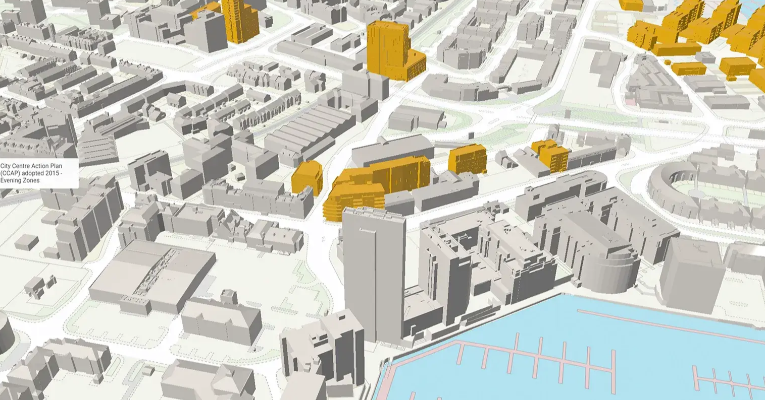
Data-Driven Insights for Precision and Clarity.
Leverage relevant planning data layers from both public and private sector sources for each city. Instantly identify if your site is near listed buildings or within a conservation area, and assess key factors like pollution and public accessibility to evaluate the feasibility and impact of your project.
Switch between 2D & 3D.
Seamlessly switch between realistic 3D model perspectives and precise, distortion-free 2D orthographic views for enhanced visual clarity and detail.
Powerful urban development tools to drive informed, impactful decisions.
Navigate every design phase with our development feature software, including the renowned contested timeline. Present a project’s past, present, and future in an engaging and digestible way to enhance project management and stakeholder collaboration.
View buildings and sites from any angle you desire.
Choose multiple angles and camera settings, showcase detailed viewshed analysis, dynamic feasibility studies, and immersive visuals that captivate stakeholders—perfect for bids, design meetings, and presentations. Give your team the competitive edge.
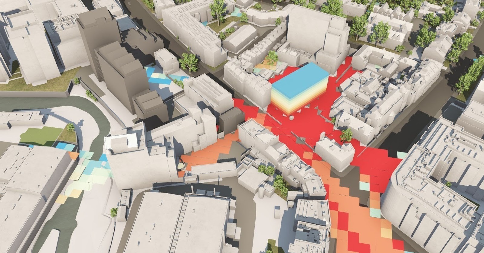
Analyse the impact of atmospherics, sunlight and weather.
Understand the impact of light and weather at an early stage - for any time, any day of the year - in seconds. See how a building might encroach on daylight, where to position windows and balconies, and more.
VU.CITY Case Studies
See how leading built environment experts are using VU.CITY
-1-1-1.png)
Trusted by 6,000+ users across 26 cities
Architects, developers, local authorities, urban planners, and more trust VU.CITY to help achieve their goals.
Organise and visualise your geospatial data in accurate context with our comprehensive suite of digital design and development tools.
VU.CITY seamlessly integrates with leading 3D digital software for an easy fit into existing workflows.
We are compatible with the biggest 3D software providers so that you can focus on your designs and plans with minimal disruption.
SiteSolve is our early-stage site exploration and generative design tool. Find out more.

Optimise FBX exports from Revit with our VU.CITY Revit Plugin and Update Agent. Embed materials, maintain positioning, and more.
Export SKP models to FBX using our VU.CITY SketchUp Plugin (beta). Produce FBX files optimised for use in VU.CITY.
Optimise and fix common issues with FBX models using our VU.CITY Blender Add-in. It's the best model editor we've come across.
IN YOUR WORDS
“ We’re bringing in architects and our clients and different consultants in one room and we’re viewing the drawing, the architecture and the massing through VU.CITY. ”

26 UK & International Cities
Over 3,000+ sq km accurate to 15cm | Tools to scope, create & collaborate on designs
Explore digital 3D geospatial solutions for the built environment
VU.CITY provides clear, powerful tools for key decision-makers across the built environment, helping them visualise and shape the future of cities with confidence and precision.
Make smarter decisions with data-driven insights, from infrastructure to sustainability.
Unlock the power of Generative AI for optimal design and streamlined decision-making.
Bring your designs to 3D life with state-of-the-art modelling tools.
Collaborate seamlessly across studies, planning, and design.
Utilise advanced 3D models and a data-driven approach with our flexible ZTV service.
Bring Your Vision to Life with a 3D Flythrough Video.
Shape Tomorrow’s Cities, Today.
Begin Your Free Trial Now.
