




Every planning consultant has spent an afternoon comparing 3D city platforms and come away less certain than when they started. The feature lists blur together and nobody's brochure mentions the bit where your daylight assessment falls apart because the model was six months out of date.
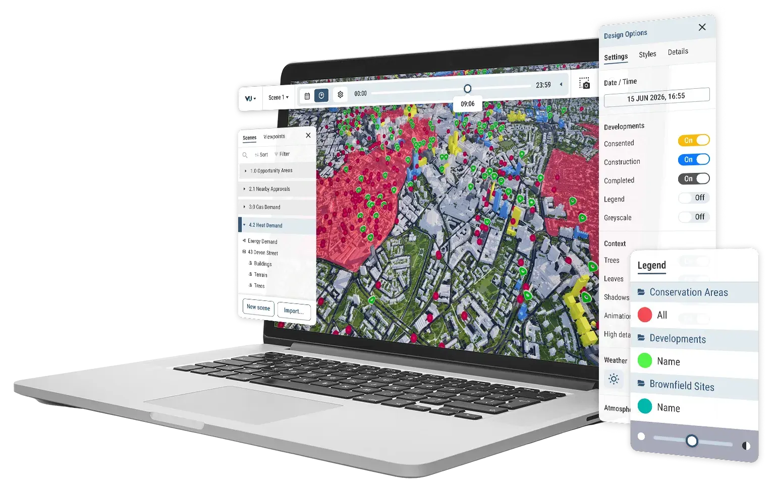
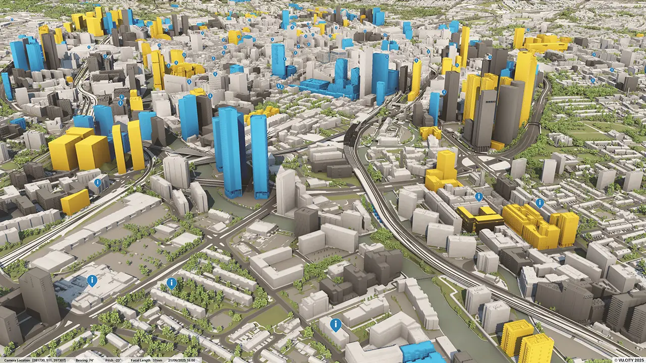
Choosing the right 3D urban planning platform is less about the longest feature list and more about which tool fits the way you work. VU.CITY helps planners, architects, and developers test massing, check skyline impact, and reduce planning risk in accurate city context.
Key Factors in Choosing 3D Urban Planning Platforms
- Model accuracy and regular data updates determine whether your 3D analysis holds up at planning committee.
- Planning-specific workflows are more useful than repurposed generic 3D tools for real feasibility and risk assessment.
- Massing analysis and skyline impact tools should reflect verified constraints and real geometry, not idealised approximations.
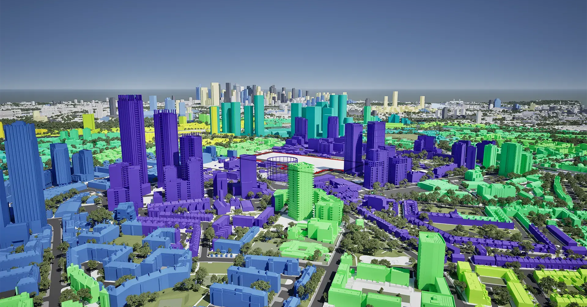
- VU.CITY covers 26 cities with 15cm-accurate 3D models purpose-built for planning and development feasibility decisions.
- Collaboration features help close the gap between technical design intent and how stakeholders actually understand proposals.
Core Evaluation Criteria for 3D Urban Planning Platforms
1. Model Accuracy and Data Currency
A 3D city model is only as useful as its accuracy. If the geometry is approximate or the building data has not been refreshed recently, every analysis you build on top of it carries that error forward into committee reports and design decisions.
Look for platforms that specify geometric accuracy to centimetre-level precision and maintain regular update cycles. VU.CITY's models are accurate to 15cm across more than 3,000 square kilometres. Outdated models create expensive surprises at exactly the wrong moment.
2. Planning-Ready Workflows
Many 3D tools started life in architecture or gaming and were later adapted for planning. That adaptation often shows. Planning officers and development managers need tools that already understand local plan policies, protected views, and height restrictions without manual configuration.
A platform built for planning workflows lets you load an applicant's massing model and test it against real site constraints straightaway. A repurposed CAD tool requires you to build that context from scratch, which is slow, prone to error, and rarely appreciated.
3. Massing Analysis and Feasibility Testing
Massing analysis is where most development proposals either gain confidence or start to unravel. Importing a concept model, positioning it accurately in city context, and testing height, bulk, and form against known constraints saves weeks of rework later in the process.
VU.CITY's SiteSolve tool supports early-stage site exploration and generative design testing directly in the 3D city model. Catching a massing problem at feasibility costs a few hours of adjustment. Catching it after the design is locked in costs considerably more.
4. Skyline and Visual Impact Assessment
Skyline impact is one of those issues that rarely appears in a spreadsheet but regularly derails applications at committee. A Zone of Theoretical Visibility analysis shows where a proposed building will be visible from, which matters enormously for heritage settings and protected views across the city.
Platforms that treat visual impact as an afterthought tend to produce assessments that look convincing on screen but miss the awkward angles. Purpose-built visual impact tools test your scheme against verified geometry and real camera positions.
5. Data Layer Integration
A 3D model of buildings alone tells you very little about development potential. Planning constraints, conservation areas, listed buildings, flood zones, transport networks, and demographic data all shape what is possible on a given site and what is not.
Platforms that integrate curated data layers directly into the 3D environment save you from assembling and reconciling separate datasets by hand. That reconciliation work is unglamorous and time-consuming, and getting it wrong has consequences that surface at exactly the worst moment.
6. Collaboration and Stakeholder Engagement
Planning decisions involve architects, developers, officers, councillors, communities, and consultants, often in the same room, frequently talking past each other. A platform that supports multi-user collaboration and accessible visual outputs helps bridge the gap between technical drawings and public understanding.
VU.CITY is trusted by over 6,000 users across 26 cities, partly because its models are legible to people who did not train in architecture. A before-and-after view of a site does more to build genuine support, or surface real concerns, than a stack of 2D elevation drawings ever could.
7. Interoperability with Existing Design Tools
No 3D planning platform sits in isolation. Architects work in Revit, Rhino, or SketchUp. Engineers use Civil 3D. GIS teams rely on QGIS or other spatial tools. A platform that cannot import and export models in the formats your team already uses creates bottlenecks rather than solving them.
Look for native plugins or direct format support. VU.CITY integrates with Revit, SketchUp, and Blender through dedicated plugins, which means your existing modelling work carries straight into the city context without rebuilding anything.
8. Temporal and Atmospheric Analysis
Sunlight, shadow, and weather conditions change throughout the year, and so does the impact of a proposed building on its neighbours. Platforms that let you simulate daylight and overshadowing for any time, any day of the year give you evidence that holds up under scrutiny at every stage.
A static shadow study taken from a single favourable angle is not the same thing as a full atmospheric analysis. Planning officers and local residents will both notice the difference, and they will bring it up at exactly the wrong moment.
9. City-Scale Coverage Versus Site-Specific Tools
Some platforms model individual sites in high detail but cannot show you the cumulative impact of multiple developments across a district. Others offer city-wide coverage but lack the resolution for site-level decisions.
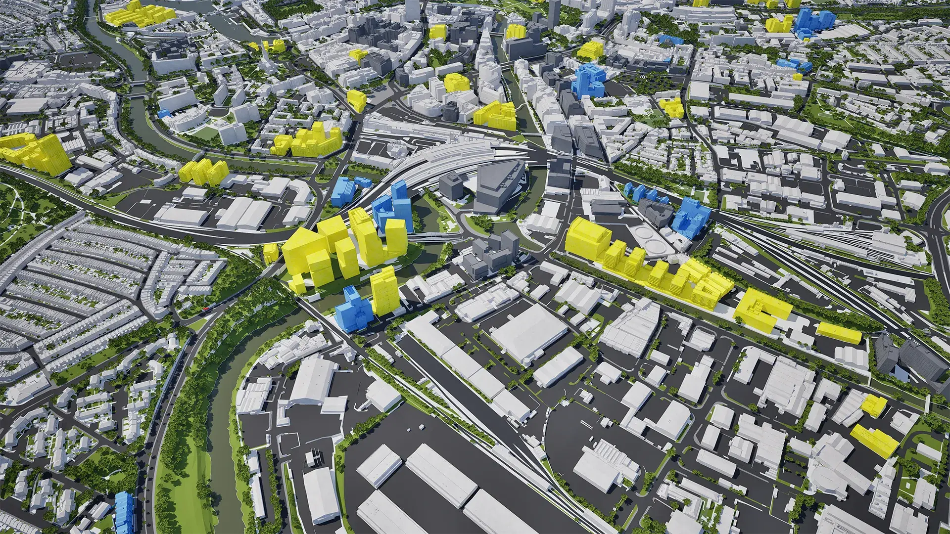
The question is whether you need both scales in a single environment. A digital twin for urban planning that covers an entire city at high accuracy lets you move between strategic and site-specific analysis without switching tools. That consistency matters when you are assessing cumulative impact across an area.
10. Track Record in Real Planning Decisions
Feature lists describe what a platform can do in theory. Case studies describe what it has done under pressure. A platform used in real planning applications and committee reports carries a credibility that a polished demo cannot match.
VU.CITY's work with the City of London on skyline planning and with the London Borough of Haringey on capacity assessments shows spatial intelligence applied to real decisions. A 2026 RIBA report found 3D and digital twin adoption in planning is accelerating across UK practices.
Choosing the Right 3D Planning Platform for Your Projects
The gap between a platform that looks impressive in a demo and one that holds up through a planning cycle is wider than most feature comparisons suggest. Accuracy, planning-specific workflows, and honest visual assessment matter more than rendering quality or polished animations.
VU.CITY gives planners, architects, and developers the spatial intelligence to test proposals against real city context, from massing feasibility through to committee-ready visual evidence. Fewer surprises at committee, fewer late objections, and decisions built on verified data rather than assumptions.
The right platform is the one that shows you what is actually there, and keeps showing you honestly, long after the sales demo is forgotten.
FAQs about Key Factors in Choosing 3D Urban Planning Platforms
What makes a 3D planning platform different from generic 3D modelling software?
A planning platform includes policy data, protected views, and planning-specific analysis tools. VU.CITY integrates these planning layers directly into the city model so you can assess proposals against real constraints rather than building your own context.
How important is model accuracy when evaluating platforms?
Accuracy determines whether your analysis survives scrutiny at committee. A model that is off by a few metres produces misleading daylight or height assessments. VU.CITY's 15cm accuracy reduces that risk across more than 3,000 square kilometres.
Can 3D urban planning platforms help with public engagement?
Accurate 3D models make proposals legible to non-specialists. Stakeholders can see what a development will look like in context, which builds understanding and surfaces concerns earlier. VU.CITY supports this through visual outputs that do not require technical training to read.
What role does massing analysis play in platform evaluation?
Massing analysis tests whether a building's height, bulk, and form work on a given site before you commit to a detailed design. Platforms that allow rapid iteration in real city context help you catch feasibility issues before they become expensive problems.
Should I prioritise city-scale coverage or site-level detail?
Both matter. City-scale coverage shows cumulative impact across a district. Site-level detail supports application-quality analysis. VU.CITY offers both in a single environment across 26 cities, so you do not have to choose.
How do I assess whether a platform fits my existing design workflow?
Check for native integrations with the tools your team uses, such as Revit, SketchUp, or Rhino. A platform that forces you to rebuild models adds time and introduces errors. VU.CITY connects with major design tools through dedicated plugins.

VU.CITY Case Studies
See how leading built environment experts are using VU.CITY
Shape Tomorrow’s Cities, Today.
Begin Your Free Trial Now.