
VU.CITY in Action
Discover how our forward-thinking users are making design and planning decisions the smart way - by using VU.CITY to successfully test, explain and achieve their ideas, and efficiently involve stakeholders in decision-making.

"The more people that are on board with VU.CITY, it will make the process a lot more streamlined and a lot easier."

"Planning authorities trust this information which is very important during the planning design and determination process."

The challenge: rethinking public consultation Southampton City Council faced a familiar challenge: the local community wasn't engaging with planning c...
We sat down with Colin Smith, Senior Townscape Consultant at Lichfields, whose background in architecture and four years of experience with VU.CITY ha...
-1-1-1.png)
Background The City of London is synonymous with iconic architecture, from the enduring grandeur of St. Paul’s Cathedral to the cutting-edge design of...
Designing Better Places, Together. Corstorphine & Wright and VU.CITY Corstorphine & Wright Architects operate across the UK, from Glasgow to London, w...
" Key takeaways \n \n \n Faster Feasibility Studies: VU.CITY helped speed up initial assessments and design iterations. \n \n \n Better Client Communi...
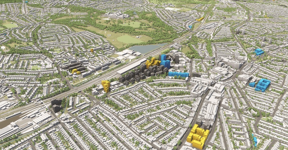
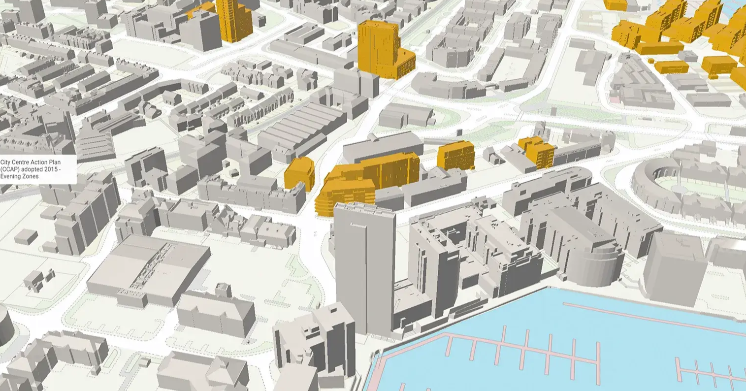
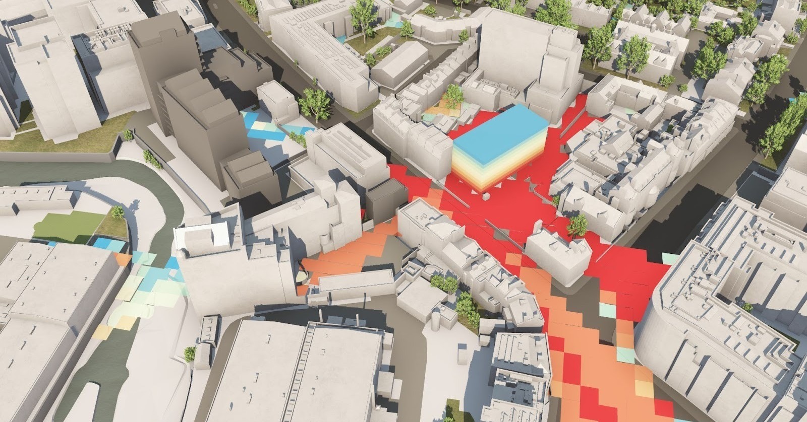
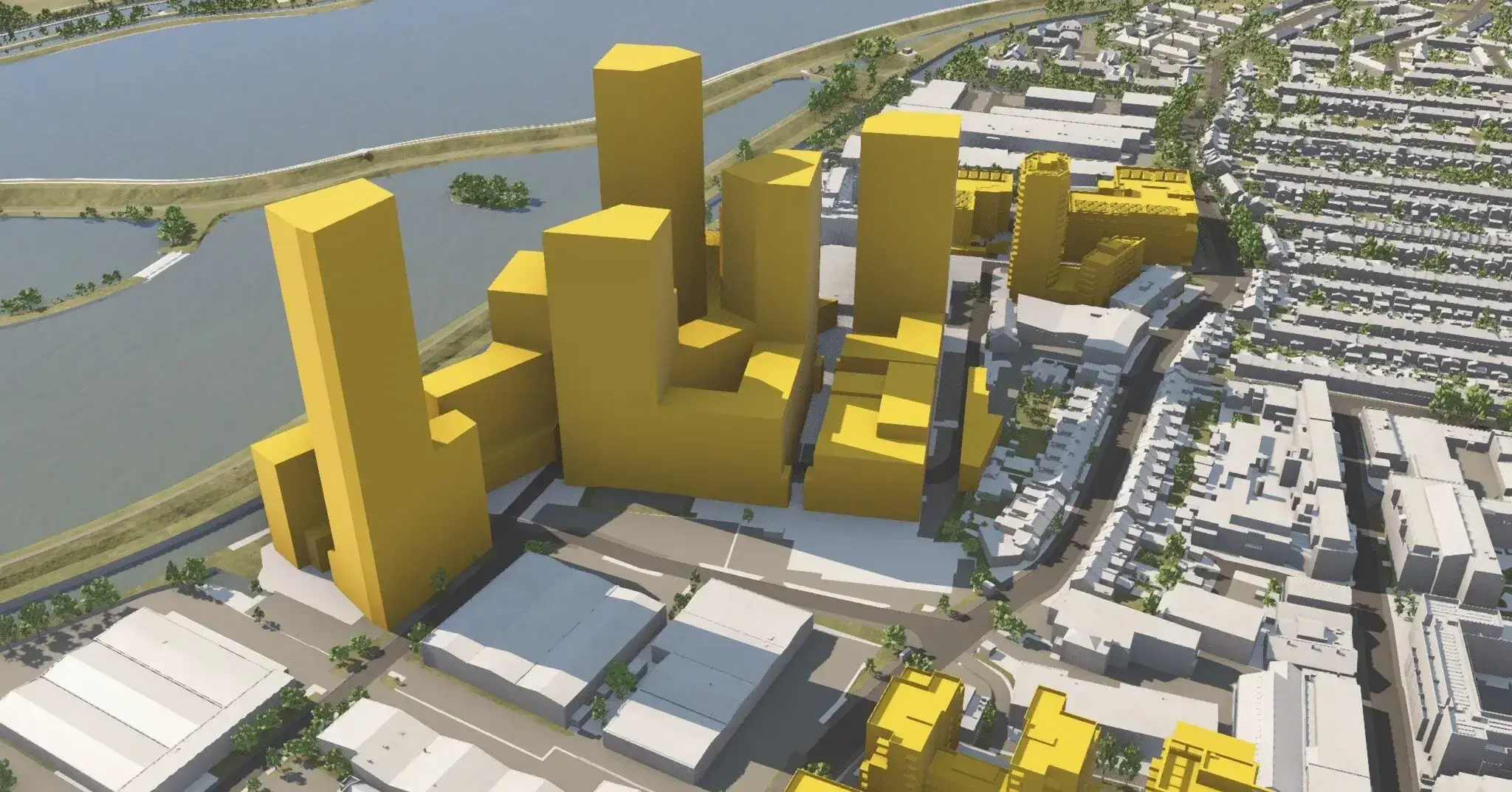
The Challenge Historically, the task has involved either the application of blunt formula or resource intensive studies by architects, urban designers...
How T2S Architecture utilises VU.CITY's Geometry Service bring their designs to life T2S Architecture, a forward-thinking architectural practice led b...
How Allies and Morrison Utilises VU.CITY to Boost Efficiency in Competitions and Feasibility Studies
How Allies and Morrison Utilises VU.CITY to Boost Efficiency in Competitions and Feasibility Studies With project programmes ever tightening, architec...
Shape Tomorrow’s Cities, Today.
Begin Your Free Trial Now.
