Niazi Roden Architects

With protected sightlines being so high up on the planning committee’s judging criteria for a proposed development in Victoria, London, Niazi Roden Architects knew that getting their scheme approved would be a challenge. Discover how VU.CITY removed 2D guesswork and helped save them time and money.

Niazi Roden Architects

David Roden Architects
Niazi Roden Architects design visualised in VU.CITY London


Saving time and money by removing 2D guesswork

Niazi Roden Architects


When David Roden saw a demo of VU.CITY at MIPIM, he immediately recognised the many benefits for his business. The practice adopted our 3D smart city design and planning platform in September 2018 – and has never looked back. 

The need for speed

Niazi Roden Architects specialise in masterplanning, urban regeneration, mixed use developments, residential, commercial, research and technology buildings.


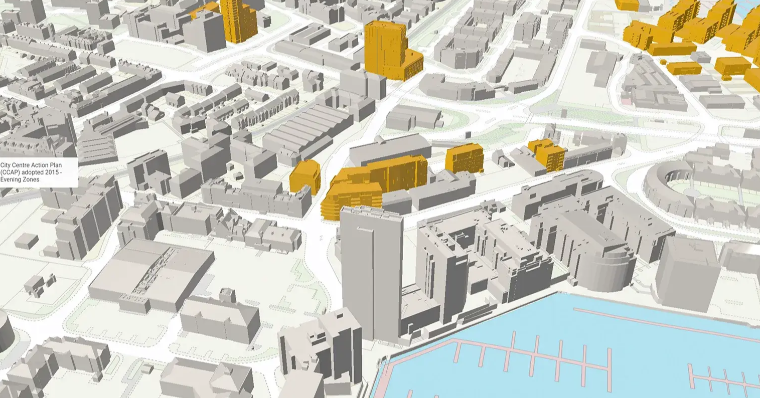
During the pre-app process of a proposed development in Victoria  (4-8 Victoria Street), London, the team knew that getting their scheme approved would be a challenge, particularly with protected sightlines being so high up on the planning committee’s judging criteria.


Any slippages in time could result in different stages of development overlapping – at great cost. 


They needed to be able to make smart decisions, and get others to approve their designs quickly.


How VU.CITY helped highlight and solve problems

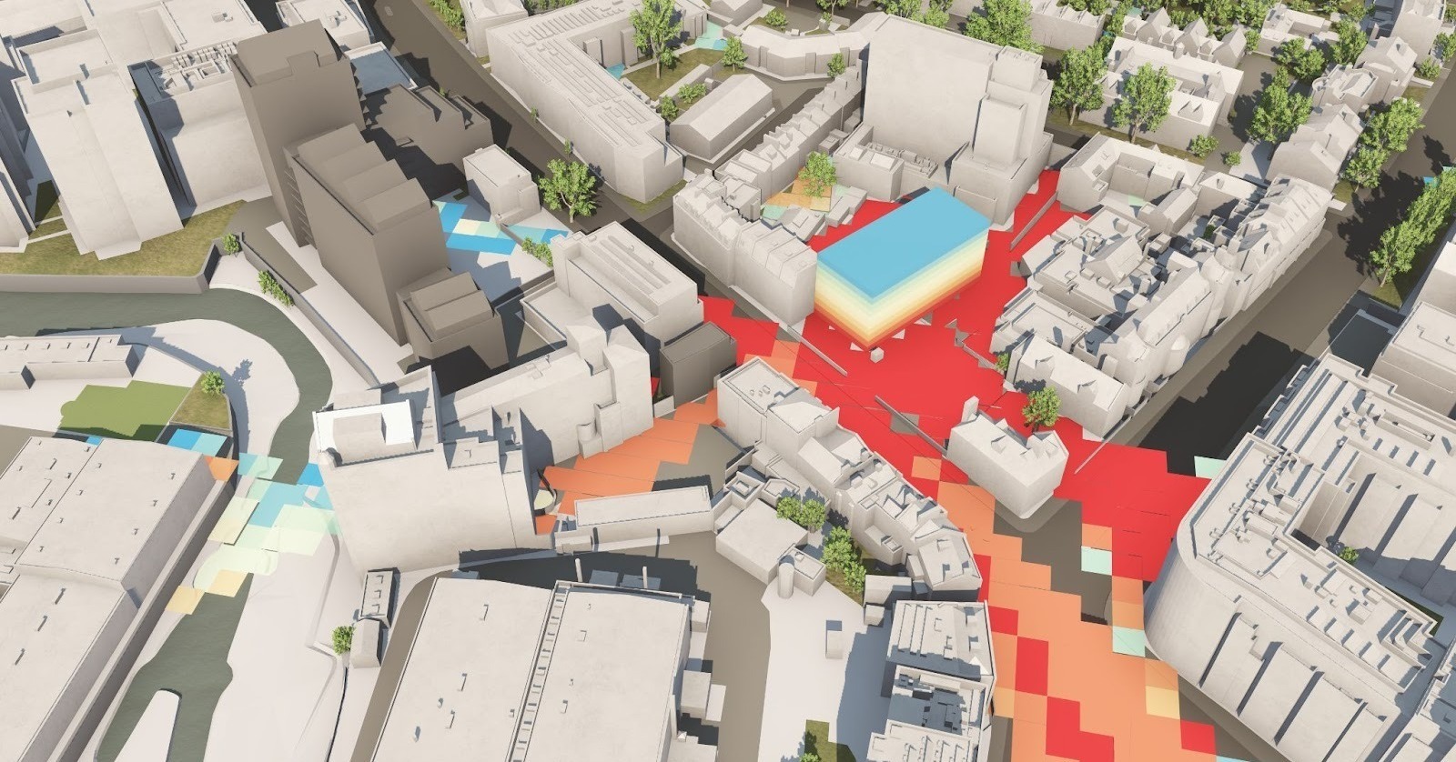
They realised how useful the accuracy of the landscape was thanks to VU.CITY, particularly when dealing with townscape and heritage issues. Accurately determining the heights of surrounding buildings and bringing their “townscaping” in-house saved them weeks of reports and verification.


VU.CITY helped highlight issues, such as the protruding plant area on their scheme’s rooftop. Simply adjusting the position in VU.CITY allowed them to find a way around the problem in a short amount of time.


Achieving planning permission at committee level

When presenting their scheme to Westminster Council planning committee, the architects could accurately prove that all considerations had been taken not to negatively impact the surrounding area. What might have been viewed as areas of concern dropped off the agenda and the risk of not getting permission fell dramatically. Their application was successful.


Niazi Roden Architects regularly use VU.CITY in presentations and are so impressed with how they can now design and plan projects in 3D with smart city data that they frequently discuss the platform’s merits with their peers.

Section Intro Icon

Create smart cities the smart way

VU.CITY helps you visualize, organise and analyse data clearly and easily so that everyone involved can make better and quicker decisions.

VU.CITY covers the whole of London and 25 major UK and international cities.

Transform design and planning

Quickly identify and appraise sites. VU.CITY's visualization, design functionality and planning data, allow you to optimise your designs.

Transform design and planning

Build trust and collaboration

Now everyone involved can have a clear, universal understanding of what’s proposed and why, in a single, secure place. VU.CITY makes decision-making democratic and fair.

Build trust and collaboration

Improve
outcomes

Remove barriers and minimise risks early. Have confidence in your designs and plans. Increase buy-in for project success.

Improve outcomes

Test out ideas in situ, from one building to a masterplan. Create your vision and submissions with confidence.

Collate site information in one place

Collate site information in one place

Communicate complex spatial arrangements

Communicate complex spatial arrangements

Make documentation stand up and stand out

Make documentation stand up and stand out

Speed up planning conversations

Speed up planning conversations

Strengthen relationships

Strengthen relationships

Create winning submissions

Create winning submissions

Discover where there is potential for change, and help everyone easily understand what’s involved and why.

Collate site information in one place

Collate site information in one place

Communicate complex spatial arrangements

Communicate complex spatial arrangements

Speed up the planning process

Speed up the planning process

Speed up planning conversations

Speed up planning conversations

Strengthen relationships

Strengthen relationships

Create winning submissions

Create winning submissions

Reduce guesswork and unwanted costs – make the right decisions for the right outcomes, faster.

Appraise site capacity and viability, faster

Appraise site capacity and viability, faster

Save time and costs through collaboration

Save time and costs through collaboration

Reduce planning uncertainties; increase buy-in

Reduce planning uncertainties; increase buy-in

Speed up the planning process with better informed decisions

Speed up the planning process with better informed decisions

Sell or lease earlier to realise profits sooner

Sell or lease earlier to realise profits sooner

Understand designs and plans with ease, and make decisions with clarity to benefit your city and your communities.

Make the best possible decisions, quicker

Make the best possible decisions, quicker

Collate site, scheme and planning information in one place

Collate site, scheme and planning information in one place

Standardise decision-making

Standardise decision-making

Have informed and transparent conversations

Have informed and transparent conversations

Improve how you consult on policies and plans

Improve how you consult on policies and plans

Understand the cumulative effects of planning changes

Understand the cumulative effects of planning changes
Begin with a Free Trial

Begin with a Free Trial

and start exploring VU.CITY