
ZTV Service

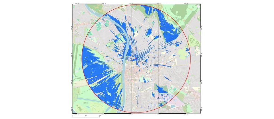
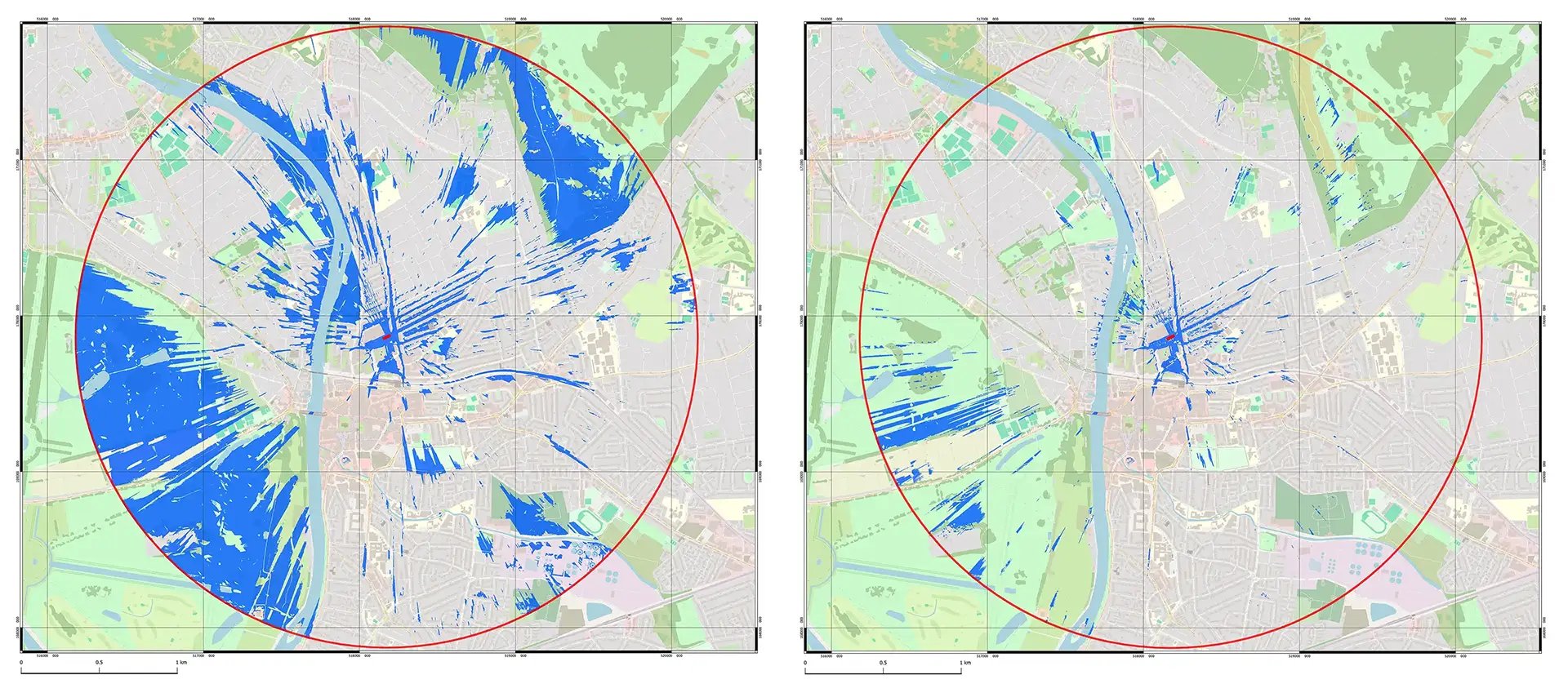
Our borough-wide sample areas and refined sample sizes (< 1m) leave no stone unturned by ensuring comprehensive coverage with granular detail
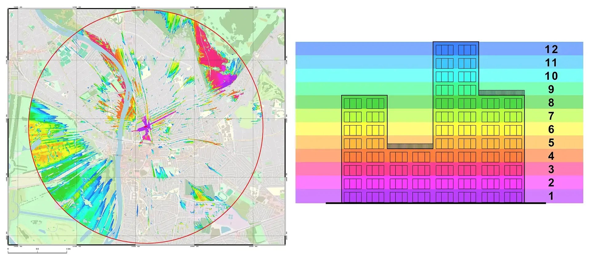
Tailor your ZTV analysis with adjustable "Height Bands" to calculate visibility across your model, including trees and consents.
Get top-quality outputs, such as PDFs and high-res images, for seamless integration into your Environmental Impact Assessments (EIAs) and other project documents
Our efficient process is streamlined to ensure you receive accurate ZTV service in just a few days. This keeps your project on track and within tight deadlines.

VU.CITY’s ZTV is Trusted and Reliable
Our ZTV service is relied on by leading organisations in the built environment industry.
Our data-driven approach and commitment to accuracy have made us the go-to partner for visual impact assessments.
26 UK & International Cities
Over 3,000+ sq km accurate to 15cm | Tools to scope, create & collaborate on designs
ZTV FAQ
Find out more about VU.CITY's ZTV & ZVI assessments.
What is the Zone of Theoretical Visibility (ZTV) service offered by VU.CITY?
Our ZTV service is an advanced, data-driven approach designed to predict the theoretical visual impact of structures, advertisements, and landscapes. By employing computer modelling, GIS analysis, and simulation techniques, we determine how visible a project could be from multiple vantage points. This helps planners and decision-makers optimise designs, ensure compliance with planning guidelines, and improve overall visual effectiveness.
How does the ZTV service differ from the Zone of Visual Influence (ZVI) analysis?
While both assessments focus on visibility, the ZTV service calculates the theoretical potential for a project's visibility based on environmental and geometric data. In contrast, the ZVI analysis evaluates the actual, measurable visual impact from specific viewpoints. By integrating both approaches, VU.CITY delivers a comprehensive visual impact assessment that combines predictive insights with real-world validation.
Who benefits from using the ZTV service and ZVI analysis?
Our services are ideal for urban planners, architects, advertisers, developers, and local authorities. Whether you're evaluating a new development, planning outdoor advertising, or ensuring visual harmony in public spaces, both the ZTV service and ZVI analysis provide critical insights. They help ensure projects are not only visually effective but also compliant with regulatory and aesthetic standards.
What technologies and methodologies are used in the ZTV service?
VU.CITY’s ZTV service leverages state-of-the-art simulation software, advanced computer modelling, and detailed GIS data analysis. These methodologies allow us to simulate various environmental scenarios and predict theoretical visibility accurately. When combined with our ZVI measurements, this integrated approach ensures robust, reliable, and actionable visual impact assessments.
How does VU.CITY ensure that its visual impact assessments are both accurate and cost-effective?
By blending the predictive power of the ZTV service with the empirical validation provided by ZVI analysis, we offer assessments that are highly accurate. Our streamlined process, advanced modelling techniques, and comprehensive data integration reduce uncertainties and minimise the need for costly field surveys. This approach results in a cost-effective solution that delivers reliable insights for informed project planning.
How can I get started with a ZTV service assessment for my project?
Getting started is easy. Simply reach out to our VU.CITY team via the form below or contact us by phone. We’ll arrange a consultation to discuss your project’s unique needs and outline a tailored approach that integrates both our ZTV service and ZVI analysis. Our experts are committed to helping you achieve precise, efficient, and budget-friendly visual impact assessments.

.png?width=640&height=640&name=VU.CITY-ZTV_HeatMap-header%201%20(1).png)
